Estels del Sud summary
Source Source: Heights are sampled along our adapted route file from a 25 m digital elevation model (EU-DEM). All elevations are to the nearest 10 m (50 ft), and distances to the nearest 100 m (0.1 miles), to reflect real accuracy.
Estels del Sud map
Our map shows our own version of the route. It started from a GPS recording of the loop shared on Wikiloc by Peter Stobbart in 2017, which we corrected to the paths we followed when we walked Estels del Sud in November 2026.
The dashed lines are the two alternatives we took: The ridge over El Negrell on stage 4 and the Parrissal walkways on stage 5.
What is Estels del Sud?
Estels del Sud ("Stars of the South") is a waymarked, 64 mi103 km circular walk linking village guesthouses, mountain refuges and a hotel through the Ports de Tortosa-Beseit massif, in the Parc Natural dels Ports. The loop crosses the border between Catalonia (Terres de l'Ebre) and Aragon (Matarranya), close to where both meet the Valencian Community.
It is normally walked in five stages, sleeping each night at one of five places: The Hotel La Fábrica de Solfa in Beceite, the Cal Gorro guesthouse in Arnes, the Ca les Barberes guesthouse in Paüls, and the Caro and Font Ferrera mountain refuges. The owners of these five places created the route, and they also waymark and maintain it.
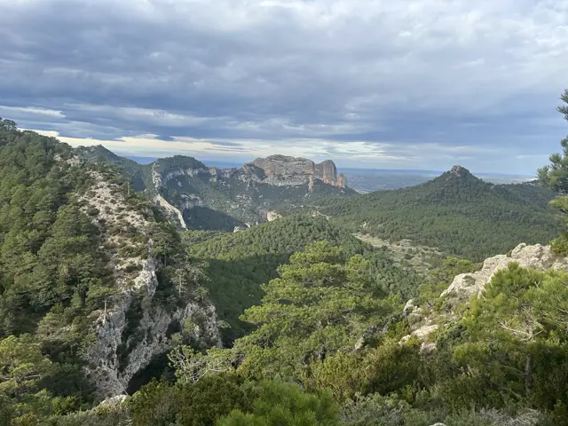
The walking goes through limestone gorges, pine and beech forest, high meadows and long ridges, past ruined farmhouses and monumental yew trees. Highlights include the Estret del Parrissal gorge near Beceite, Els Estrets d'Arnes, the Roques de Benet and the Penyagalera viewpoint.
Estels del Sud stages
The official route, as described on the Estels del Sud website, has five stages. The map above shows it starting and finishing in Beceite and going clockwise through Arnes, Paüls, Caro and Font Ferrera. In practice, the loop can start at any of the five stops and be walked in either direction.
Whichever way round, every stage ends at one of the five places to stay. The days are long: Around 19–14 mi22 km and 7–9 hours of walking, more in hot weather or at a slower pace.
| Stage | From | To | Distance | Ascent | Descent | Time |
|---|---|---|---|---|---|---|
| 1 | Beceite (Hotel La Fábrica de Solfa) | Arnes (Cal Gorro) | 14 mi22.1 km | 3,300 ft1,000 m | 3,400 ft1,040 m | 8–9 h |
| 2 | Arnes (Cal Gorro) | Paüls (Ca les Barberes) | 13 mi21.0 km | 2,750 ft840 m | 3,400 ft1,030 m | 8–9 h |
| 3 | Paüls (Ca les Barberes) | Refugi de Caro | 14 mi21.9 km | 4,800 ft1,460 m | 2,250 ft680 m | 8–9 h |
| 4 | Refugi de Caro | Refugi de la Font Ferrera | 12 mi18.8 km | 2,500 ft760 m | 2,300 ft700 m | 7–8 h |
| 5 | Refugi de la Font Ferrera | Beceite (Hotel La Fábrica de Solfa) | 12 mi19.5 km | 1,850 ft570 m | 3,850 ft1,180 m | 7–8 h |
Distance, ascent and descent are measured on our adapted route, with heights from the 25 m European elevation model (EU-DEM): About 103 km and 4,630 m of ascent in total. Times are the official walking times from Estels del Sud.
Stage 1: Beceite to Arnes
The route leaves Beceite on a PR path and climbs to the summit of the Penyagalera, a fine viewpoint over the Matarranya. It drops past the Coll de Pelele to the river Algars, crosses the Coll de Xertó to the ruined Mas de les Valls, and continues by the Coll de la Creu and the Mas Nou to Arnes.
Stage 2: Arnes to Paüls
From Arnes the route climbs through the gorge of Els Estrets d'Arnes, then follows the Franqueta road and the track below the Roques de Benet to the Coll de la Terra. A path then drops to the Barranc de Piquer, passes the ruined Masos de Fandos and the Mas de les Crevetes, and climbs to the Coll de la Gilaberta before a steep descent to Paüls.
Stage 3: Paüls to the Refugi de Caro
The big climb of the loop. From the Sant Roc picnic area above Paüls, the route follows the GR-7 up to the Coll del Camp and along a chain of cols below l'Espina, across the exposed Rases de Marraco and past the unstaffed Refugi de les Clotes. It then crosses the meadows of Les Foies, where cattle and bulls graze, before the last stretch to the Refugi de Caro.
Stage 4: Refugi de Caro to Refugi de la Font Ferrera
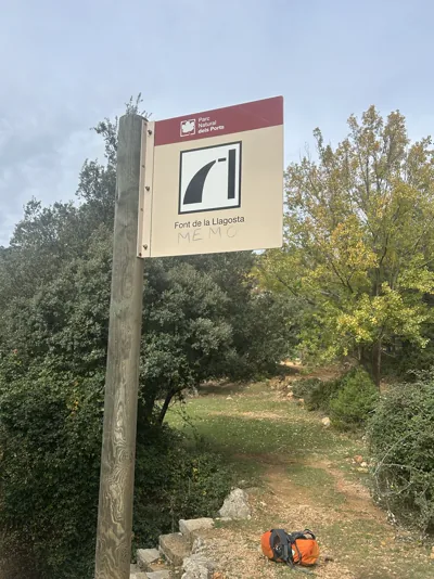
The highest stage. From the Coll de la Carrasqueta, a path rolls up and down past the Cova del Vidre, a cave high in a cliff, to the Font de la Llagosta and Casetes Velles. It passes the closed Mas del Frare refuge and the Font del Bassiol before reaching the Font Ferrera refuge in the pine forest near Fredes.
Near the end of the stage, an alternative (dashed on the map) climbs El Negrell and follows its ridge: A short, very pleasant detour with good views.
Stage 5: Refugi de la Font Ferrera to Beceite
Mostly downhill. The route crosses the Prats d'en Rubera and drops down the Barranc de la Coscollosa, home to some huge old yew trees, to the river Matarranya and the Estret del Parrissal. The main route climbs over the Pas del Romeret, a short section with steps and chains but no safety line.
The easier alternative, dashed on the map, stays down by the river on the walkways. Walkers with an Estels del Sud booking don't pay the walkway fee, and coming down from the refuge towards Beceite, as the clockwise loop does, nobody is likely to check.
When the river is high or flash floods are possible, the route detours through Aranys instead, avoiding the Parrissal and its gorges altogether. This detour isn't on our map, but it can be traced on the official walking maps.
The last few kilometres into Beceite follow paths rather than the Parrissal track.
Estels del Sud elevation profile
Estels del Sud climbs and descends about 15,200 ft4,630 m over 64 mi103 km, so it is a steady up-and-down rather than one big mountain day. The loop's low point is Paüls, at about 1,000 ft300 m, and its high point is about 4,100 ft1,250 m on the stage between the Caro and Font Ferrera refuges.
The hardest day is from Paüls up to the Refugi de Caro, which climbs almost 4,900 ft1,500 m. The easiest on the legs is probably the last stage from Font Ferrera, mostly downhill to Beceite, although some walkers find the stage between the two refuges easier because it is the flattest. That can change in winter, when the higher ground may be under snow.
292 m – 1,249 m958 ft – 4,098 ft above sea level
Ascent & descent analysis
The chart shows the loop walked clockwise, the usual direction. That way round, the descents tend to be slightly steeper than the climbs, though the difference is small.
The biggest change in the other direction is the 3,950 ft1,200 m between Paüls and Caro, which becomes a long descent instead of the big climb of the loop.
Gradient
How long does Estels del Sud take?
Estels del Sud is usually walked in five days, with one stage a day and 7–9 hours of walking. The loop is 64 mi103 km long, with about 15,200 ft4,630 m of ascent and descent.
Can it start anywhere? Yes. As a loop, it can start and finish at any of the five places to stay, in either direction. Beceite, Arnes and Paüls are villages with road access; the two refuges can also be reached by mountain roads, though the drive is much longer.
Shorter four- and three-day loops also exist. They use the same stops plus some alternative stages, such as Refugi de Caro to Arnes via Terranyes and Beceite to the Refugi de Caro via Carlares, and are described in the guidebook that comes in the "morralet", the pack handed out at the start to walkers who book through Estels del Sud.
How hard is Estels del Sud?
Estels del Sud is a demanding walk, but neither technical nor punishing. The challenge is the length of the days rather than the terrain: Most stages are 19–14 mi22 km with 500–4,900 ft1,500 m of climbing, on a mix of rocky paths, forest tracks and some quiet roads.
Apart from the Pas del Romeret, which can be avoided, there is no real scrambling, and thunderstorms are far less of a worry than on the GR20 in Corsica. It is also much less remote and much less punishing than the Cape Wrath Trail in Scotland.
There are a few places that need care. The Rases de Marraco, on the way to Caro, are exposed in wind or fog. On the last stage, the Pas del Romeret has chains and steps without a safety line; the river walkways below it are an easier alternative. Cattle and bulls graze around Les Foies.
It suits fit hillwalkers used to back-to-back long days.
Is Estels del Sud waymarked?
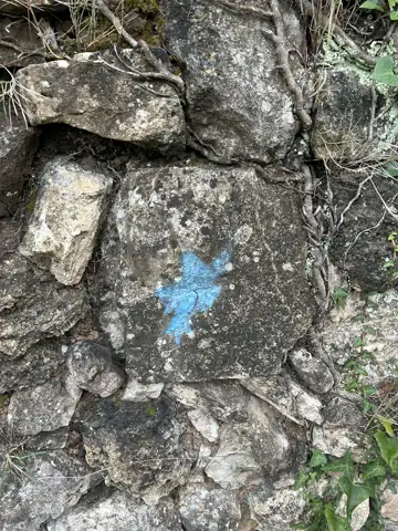
Mostly. Estels del Sud is marked with its own blue star, often alongside GR-7, GR-8 and PR waymarks. In November 2026, though, many of the stars had faded, there were none at all from the Parrissal walkways to about halfway to Arnes, and one wrong waymark sent us off course.
We strongly recommend a GPS track on a phone or watch, which makes navigation much easier: The GPX tracks are on the Estels del Sud website. A map is still useful as a backup.
Estels del Sud refuges and accommodation
On the map above, each of the five stops shows its accommodation in its marker. The five places to stay are:
| Stop | Where | Type | Indicative price (Nov 2026) |
|---|---|---|---|
| Hotel La Fábrica de Solfa | Beceite | Hotel in an old paper mill | Half board about €85 |
| Cal Gorro | Arnes | Rural guesthouse | B&B about €40; dinner at a village restaurant |
| Ca les Barberes | Paüls | Rural guesthouse | Bed about €33, breakfast €10, dinner €28 |
| Refugi de Caro | Below Mont Caro, about 3,600 ft1,100 m | Staffed mountain refuge | Half board about €48–51 |
| Refugi de la Font Ferrera | Near Fredes, about 3,850 ft1,170 m | Staffed mountain refuge | Half board about €64 |
Indicative prices as of November 2026, per person per night in a shared room, including tourist tax. A packed lunch costs €9–14 extra at each stop, and single rooms cost more.
How to book the Estels del Sud refuges
The simplest way to book is through Estels del Sud itself: The booking form on estelsdelsud.com takes the dates and the preferred start, and they arrange all five nights. In low season this can be done just a few days ahead. To fit other bookings, they may suggest a different starting point or direction. Each stop can also be booked directly.
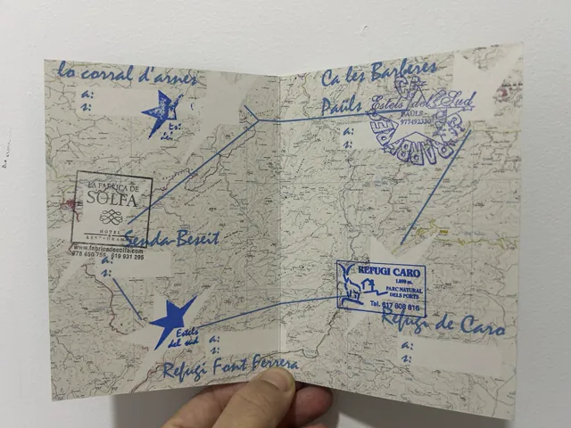
Booking through Estels del Sud costs €45 per person, which includes the map, the stage pass (the "morralet", stamped at each stop) and the official T-shirt, given out on the last night. Half board is required at every stop, about €350 per person for the five nights, and picnic lunches are optional at about €12 each. In 2026 the full trip came to about €470 per person, picnics included.
Insurance is compulsory: Either a mountain federation card, or the Estels del Sud policy at €12.50 per person. Without one, the walk cannot start. The first payment covers the fee, the insurance and a €20 deposit per stop; the rest is paid at each stop. The refuges take cash only, and the other stops also take cards. Rooms are held until 20:00 on the day, and dinner is often served at 20:00.
Estels del Sud can also arrange luggage transfers between the stops, a mountain guide, and a printed walking guide that describes the route in both directions.
Is a sleeping bag needed on Estels del Sud?
No. The hotel and the two village guesthouses provide bedding, and the two mountain refuges have blankets, but a sleeping bag liner and a pillowcase are a good idea.
Can Estels del Sud be walked independently?
Yes. Each stop can be booked directly, without going through Estels del Sud, and it is also possible to carry a tent. Bivouacking (pitching late and packing up at first light) is generally tolerated in the natural park, as a local mountain guide told us.
Water is the main thing to plan for. The higher ground has very little, especially the long stretch between Paüls and the Font Ferrera refuge. The staffed refuges are not open every day, and the unstaffed refuges along the way have no water.
Estels del Sud weather by month
Estels del Sud has no fixed season: Walkers give Estels del Sud their dates, and the stages are booked around them. All five stops were open midweek in mid-November 2026, but opening days can be limited in winter, so dates are confirmed at booking.
Spring and autumn are the most popular seasons. Summer is hot on the low stages around Arnes, Paüls and Beceite, and winter brings short days and cold nights at the two refuges, which sit above 3,600 ft1,100 m.
The weather data has been obtained using the Open-Meteo historical weather API.
Month by month
For each month of the season, over the last five years: the typical temperatures on the route, from night-time at the high point to daytime at the low point, the rain, averaged along the route, and the daylight (local time).
January
Cold and quiet, with the shortest days of the year. Frost and occasional snow are likely around the Caro and Font Ferrera refuges, and the long stages leave little spare daylight. Not every stop is open every day in winter.
February
Still winter in the high part of the Ports, with cold nights at the refuges and the chance of snow on the stages around Caro. Daylight is short for 12 mi20 km days, so early starts are needed.
March
Days lengthen quickly, but March is often one of the wettest months here. Rivers and springs are usually full, which can make the river crossings on the Parrissal and Algars stages wetter.
April
A good month: Mild days, green valleys and flowing springs. Nights at the two refuges are still cold. Easter weekends are busy and book up early.
May
One of the best months, with long days, warm but not hot weather and plenty of water on the route. Showers and the odd thunderstorm are possible.
June
Long days and warm weather. The low stages around Arnes, Paüls and Beceite get hot in the afternoon, making early starts and plenty of water essential.
July
Hot, especially on the low stages, where afternoons regularly pass 30°C86°F. Springs can run low. The Parc Natural can restrict access on days of high fire risk.
August
The hottest and driest month, and the busiest on the Parrissal walkways near Beceite. Starts at first light, extra water and afternoon thunderstorms are all part of the month.
September
Still warm early in the month, cooling towards the end. Late-summer thunderstorms and the first heavy autumn rain arrive this month, so the forecast matters.
October
Usually comfortable walking temperatures and autumn colours, but October is also when the heaviest downpours of the year tend to fall. After heavy rain, river crossings can be impassable for a day or two.
November
Cooler, quieter and often clear, with good walking days between spells of rain. Daylight is getting short, so the longer stages need early starts.
December
Short, cold days, with frost at the refuges and occasional snow on the high ground. Suited to experienced winter walkers, and not every lodging is open.
Is there water all along Estels del Sud?
Not everywhere. The high limestone country in the south and south-east has almost no reliable water: When we walked it in November 2026, the only dependable sources there were the tap behind the Refugi de Caro and the Font de la Llagosta.
The north and north-west are much better watered, with plenty of rivers and pools, though the water should be filtered before drinking.
Each stop has water in the morning, and Beceite, Arnes and Paüls all have fountains and shops. The official stage descriptions list other springs, such as the Font del Morellà and the Font del Bassiol, but these can run low or dry. Carry at least 2 litres, more in warm weather, and ask at each stop about water for the next day.
Getting to Estels del Sud
Els Ports sits inland from the Ebro delta, roughly halfway between Barcelona and Valencia. The easiest places to start by public transport are Paüls and Arnes on the Catalan side, and Beceite on the Aragonese side. The nearest airports are Reus, Barcelona and Valencia.
From Barcelona
By car, it is about 2½ to 3 hours to Paüls or Arnes, on the AP-7 motorway towards Tortosa and then inland.
By train, regional services run from Barcelona to Tortosa in about 2–2½ hours. Hife also runs buses to Tortosa from Barcelona and Barcelona Airport, some with a change, in about 2 hours, but they cost considerably more than the train.
From Tortosa, the last stretch to Paüls is by Hife's local bus, which runs only a few times a day, or by taxi (about €45). That makes Paüls the easiest place to start without a car.
From Valencia
By car, it is about 2½ to 3 hours to Beceite or the Font Ferrera refuge, via the AP-7 or the A-7 towards Vinaròs and then inland through Els Ports. By public transport, trains run from Valencia to L'Aldea-Amposta-Tortosa, then by taxi or arranged transfer.
Best time of year to walk Estels del Sud
Estels del Sud can be walked all year, but the best times are from late March to early June and from late September to early December, when the temperatures suit long days, the springs are more likely to be running and the forests are at their best.
Summer is very hot on the low stages and the fire risk is high, with access sometimes restricted on days of high fire danger. In winter, heavy snow is possible above 3,300 ft1,000 m, which includes both refuges, and the days are short for 12 mi20 km stages.
If a weather warning affects the dates, Estels del Sud suggests alternative stages, and if the walk can't go ahead, the deposits can be kept for a later date within a year.
Estels del Sud course altitude statistics
Estels del Sud starts and finishes in Beceite at about 1,850 ft560 m, drops to about 1,000 ft300 m at Paüls and reaches about 4,100 ft1,250 m between the Caro and Font Ferrera refuges. Altitude itself is not an issue, but nights at the two refuges are cold outside summer.
Altitude
Below 1,500 m, altitude has a negligible effect on VO2max, which is why the line stays close to zero on this course.
TrailVu and Estels del Sud
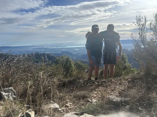
TrailVu's founders, Christian and Ben, walked Estels del Sud in November 2026, and the route on our map is the one they followed.
We loved it. One of its big attractions is that it can be walked out of season, when multi-day walks in the Pyrenees are much harder because of the cold and the snow on the passes. In November we hardly saw another walker. Most of the route feels remote, and the park itself is superb: Full of wildlife and plants, free of litter, and clearly still off the radar of most walkers and of mass tourism. The Parrissal gorge was the busiest part, and it is spectacular.
The information on this page was compiled in November 2026 from the official Estels del Sud website, the lodgings' own websites, OpenStreetMap and walkers' reports. Prices, opening days and access rules change from year to year; Estels del Sud and the lodgings have the latest information.
More about them on the About us page.